Da Nang Maps and Orientation
(Da Nang, Vietnam)
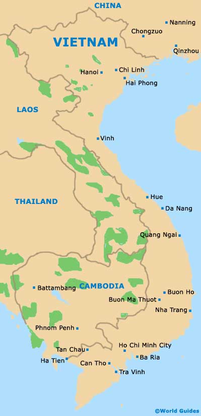
Da Nang lies on the south-central coastline of
Vietnam, alongside the mouth of the River Han and on a narrow coastal plain, overlooked by high peaks which separate the city from inland Vietnam. The city is bordered by the Thura Thien Hui province to the north and the Quang Nam province to the west and south.
Hanoi is just over 750 km / 466 miles to the north and Ho Chi Minh City lies around 960 km / 597 miles to the south. The Annamite Range runs north and inland from Da Nang, traversed by a high pass and the new tunnel avoiding the dangerous road across the pass.
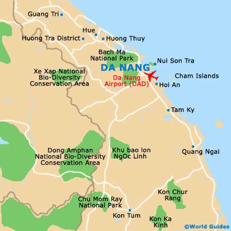
Maps and Orientation of the City
Da Nang is strung out along the Han River banks and the coastline, with a number of beaches running from the coast near the centre, to the edges of the city on either side. The downtown area contains most of the modern shops and a good few hotels and guest houses, and is where most tourists and resident expats gather. The majority of the upscale restaurants are either here or along the beaches, together with the resorts.
Further from the centre are the once independent villages drawn in as the city has expanded, with their local markets, pagodas and more traditional feel. Tourist maps giving places of interest both in the city and in its surrounding countryside should be available at upscale hotels, as well as at the travel agencies on D Bach Dang and D Hung Vuong. If a little English is spoken, local advice can be the most valuable guide of all.
- Bach Ma National Park - 25 km / 15 miles (30 minutes, north-west)
- Cham Island - 23 km / 15 miles (30 minutes, south)
- Hanoi - 752 km / 470 miles (12 hours and 45 minutes, north)
- Ho Chi Minh City (Saigon) - 960 km / 597 miles (15 hours, south)
- Hoi An - 28 km / 18 miles (30 minutes, south)
- Hue - 98 km / 61 miles (one hour 45 minutes, north)
- Marble Mountains - 10 km / 7 miles (15 minutes, south)
- My Son - 70 km / 43 miles (one hour and 15 minutes, south)
- Pleiku - 368 km / 230 miles (five hours and 30 minutes, south)
- Quang Ngai - 132 km / 82 miles (two hours and 25 minutes, south)
- Vinh - 460 km / 287 miles (seven hours and 45 minutes, north)
Map of Vietnam
Map of Da Nang